Geology and Soils of the Limestone Coast
Geological processes determine the way a landscape is expressed in terms of topography, rock types, soils, drainage, infiltration, runoff, re-charge and groundwater characteristics. Large and small scale geological processes impact on viticulture, consider slope and soil type as the result of these processes.
The Limestone Coast Wine Zone of Southeast South Australia hosts a landscape derived from the break-up of Gondwanaland, whereby the separation and movement of the Australian continent away from the Antarctic continent produced a seaway (the Southern Ocean). Basins associated with this new continental margin became subject to sedimentary infilling. It is upon these varied deposits that the Limestone Coast Wine Zone has developed. Central to this area is the Otway Basin, more specifically the westernmost portion, termed the Gambier Embayment. The timing of continental separation is generally agreed to have been initiated around 158 million years ago and is linked to global climate changes. Land contact is maintained with Antarctica until around 40 Million years ago even though rifting (splitting) was well developed. After this, the sea floor spreading rate increased and the southern seaway opened up.
The Limestone Coast is unique in its geology and geography due to the variety of natural features that exist with the area known as the Otway basin. Each feature was formed over a long period of time to be what it is today, a rough timeline of these events are as follows.
- 158 million years ago – Formation of Gondwanaland
- 40 million years ago – Separation of Gondwanaland from Antarctic Continent
- 15-38 million years ago – Laying down of Mt Gambier Limestone Deposits
- 2-5 million years ago – Lifting of Naracoorte Ranges along Kanawinka Fault line Pliocene Era
- 1.5 million years ago – Volcanic eruptions in Mt Gambier
- 1 million years ago – Starting of formation of dunal systems and infilling
- 20,000 years ago – Last dune system formed currently offshore in 50-100m of water
- 4.600 years ago – Last of Volcanic activity around Mt Gambier
These events in time lead to the formation of the following regional features
- Granite outcrops to the north around Padthaway to Boarder town
- Dunal systems that run north to south parallel to the current coast line
- Dormant volcanos around the southern areas of Mt Gambier
- Cave systems formed along the Kanawinka and Tartwaup fault lines
- Range systems near the border that rise 100m above sea level.
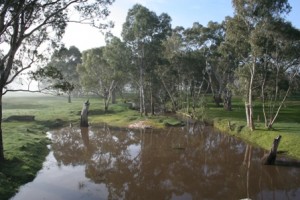
- Lagoons swamps and marshes of world significance.
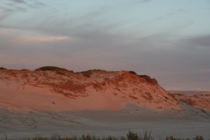
The dunal systems of the Limestone Coast are probably one of the more visual features as you travel east to west across the region. These are the result of the ingress and subsequent retreat of the sea inland, leaving behind stranded dunal systems. There are 13+ recognised dunes and the following timeline describes the formation of these dunes through the region:
- 940,000 years ago – Hynam dunes formed
- 800,000 years ago – Naracoorte Range
- 430,000 years ago – West Avenue Range
- 300,000 years ago – Reedy Creek Range
- 210,000 years ago – Robe / Beachport
- 120,000 years ago – Woakwine Range
- 20,000 years ago – offshore in 50-100m of water
- Current – Young Husband Peninsula
All of this geological activity has resulted in the range of soils that viticulturists have available to them in the Limestone Coast with 28 classes there are 20 that are significant to viticulture. The soils are broadly grouped into 5 groups, these being Shallow soils over calcrete, Textured contrast soils, Gradational loamy to clayey soils, Deep Sands and Wet soils. Each soil type has its own apparent challenges and benefits.
For more detailed information on this please visit Unearthing Viticulture in the Limestone Coast


